
malaysian naturalist, march 2017
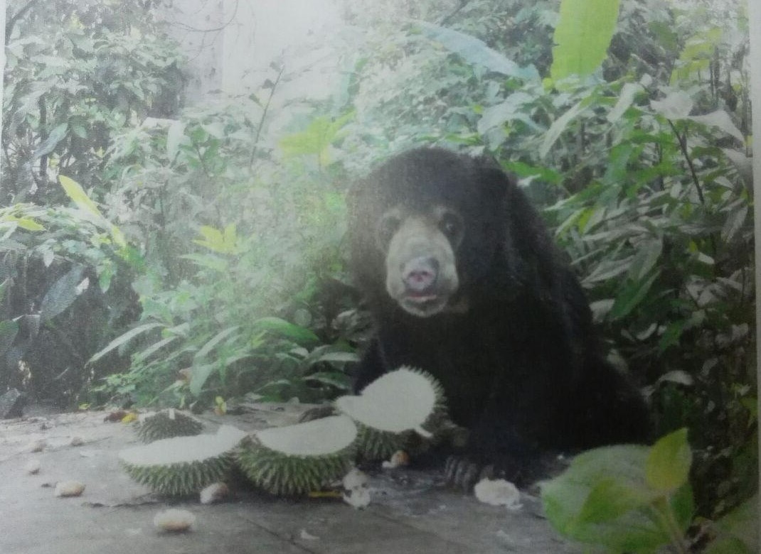
Kamaruddin, Z.A. & Shukor, M.N. of Universiti Kebangsaan Malaysia (UKM) on the use of telemetry system in the re-introduction programme of the Malayan sun bear
THE USE of telemetry tools in studying wildlife has proven to be effective in understanding movement, activity pattern, behaviour, and the way of life of an animal. This system has long been used in most countries and its manifold benefits are slowly gaining recognition and importance in Malaysia since the end of the 20th century.
The purpose of telemetry is to determine the position of animals in the wild through detection of signal-collar (GPS devices) fixed on the animal before it is released. The system contains two important components, namely sending signal and the receiving signal. Like other electronic tools, telemetry has much evolved from archaic systems which only used radio waves into a more sophisticated set-up using satellite.
In this study, three types of telemetry system were used i.e. radio frequency system, satellite system and cellular GPS system (GSM). (Note: The performance of telemetry tools largely depends on specification set up by the manufacturer. Telemetry used in this study is manufactured by Africa Wildlife Tracker.)
In order to track the collared sun bears released in the wild, two types of radio frequencies were used: VHF (Very High Frequency) receiver and UHF (Ultra-High Frequency) receiver. These tools differ in terms of radio frequency ranges that are sent and received. VHF receivers work on waves ranging between 148Mhz-160Mhz whereas UHF receivers work at larger waves ranging between 433.5Mhz-433.92Mhz. All collars used in this study use both systems simultaneously with the exception of satellite and GSM collars.
The VHF device determines the direction of the waves sent by the collar. The ability to detect the direction depends on the distance between the VHF device and the collar, also taking into account the terrain of the area. If the wave transmissions are free from blockages like hills or thick forest canopies, the wave detection become more far reaching up to 7km and the signal received is used to change the collar’s settings in accordance to the information needed.
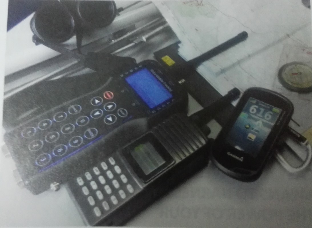
The data obtained from the collar contains historical and real position of the bears (coordinates), elevation, time, and speed of movement. In addition, the UHF device is also used to detect the position of the collar in a more detailed and accurate manner. The UHF’s capability to detect signals also depends on distance and terrain. However, its signal reception distance is very low, i.e. about 1-2km. Difference in function and capability of detecting signals between VHF and UHF will be used during tracking activities of released bears in the wild.
The bear’s position in the wild can be specified through intersection of straight-lines of the signal direction from several different areas. This method is called Triangulation. Normally, VHF device will be used at the beginning of the method. When the distance to the target area becomes closer, the UHF device is used to download the data from the collar or to change the settings.
The UHF device can function better within 100 metres radius of the bear’s location. Later, the information stored in the UHF memory will be uploaded into the AWT Software Tracker for further processing and analysis.
All collars used in this study weigh around 700g, i.e. less than 5% of the sun bear’s body weight. It’s crucial to reduce the load as this will minimise the stress on these animals while adapting to their new home. The collar has a weak point that works to detach the strap after a certain time period.
The detachment period depends on the area and weather conditions. If the strap is constantly exposed to weather changes (i.e. wet and dry) on a regular basis, the detachment occurs faster. It can also be exacerbated by attempts of the bears to remove the collar from their neck. Maximum durability of the weak point so far has been 6 months.
The satellite collar is based on a mobile global two-way communication platform utilizing two-way data satellite communication complete with GPS systems. By connecting to the internet, historical data and near-to-real time positions of the animals can be accessed remotely, i.e. without leaving the office.
The data can be programmed and changed using AWE TELEMETRY software. The Cellular collars consist of a Hawk105 (GPS-GSM) device that calculates the animal’s coordinates using a GPS. This data is then sent via the GSM network as a text message (SMS) that you can download from the internet using HAWK software.
It is undisputable that these collars provide scientists a rare glimpse into the life of the bears that is much less invasive, and help us gain insights important to protecting these amazing creatures.